
1 Kings – Map Collection
SALE Original price was: $49.00.$25.00Current price is: $25.00.
Solomon’s Northern Kingdom: Galilee and Phoenicia Map
$10.00
Solomon’s kingdom stretched into one of the Bible’s most beautiful and strategic regions.
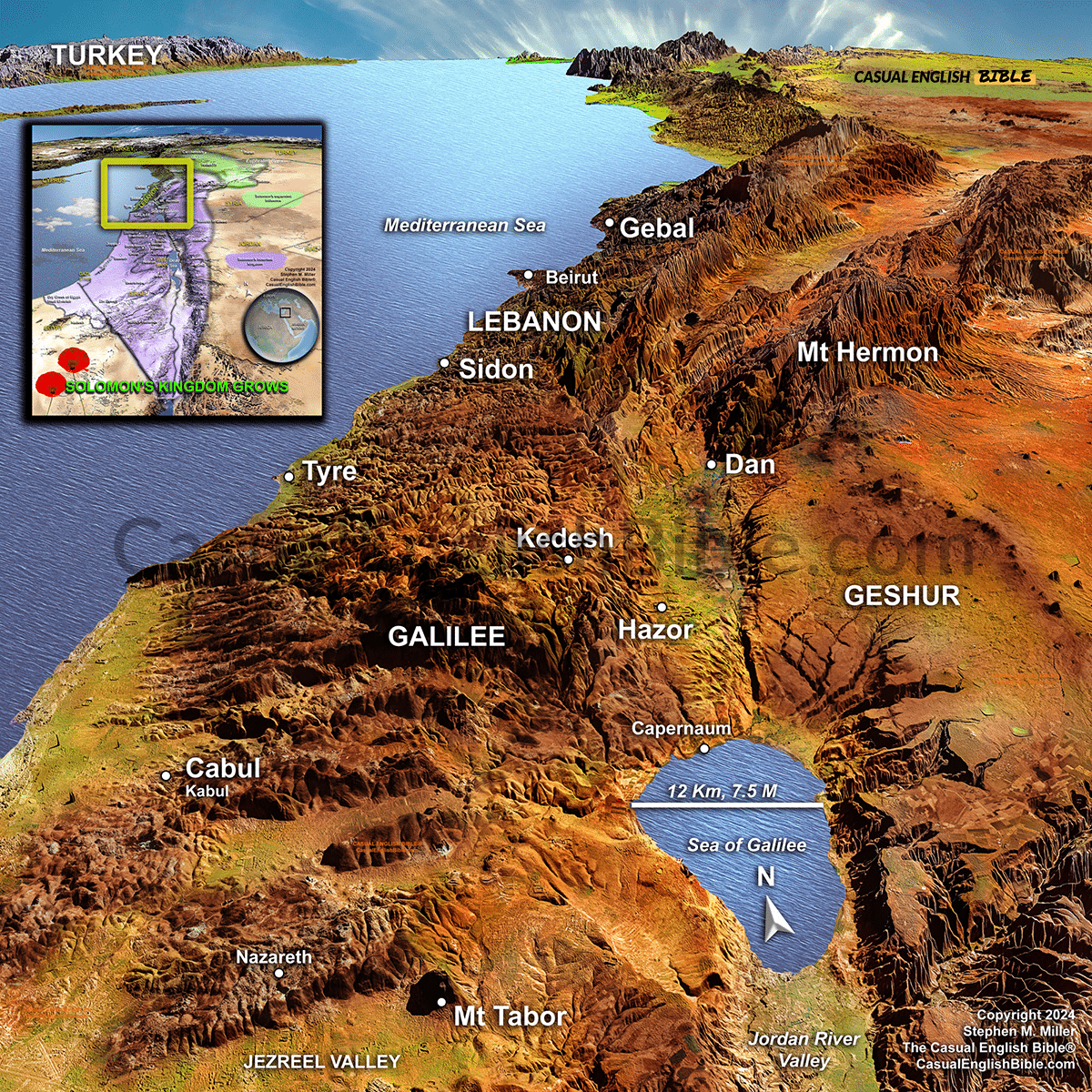
The forests of Lebanon, the shores of the Sea of Galilee, and the trade cities of Phoenicia all played important roles during Solomon’s reign. This map explores Israel’s northern frontier, where valuable resources, international partnerships, and future Bible events all came together.
Description
The northern frontier of Solomon’s kingdom
During Solomon’s reign, Israel enjoyed peace and prosperity unlike any previous generation. His alliance with King Hiram of Tyre opened the door to the famous cedar forests of Lebanon, whose timber was floated south for construction of the temple and Solomon’s palace. The nearby Phoenician ports also connected Israel to Mediterranean trade routes that brought wealth and luxury goods into the kingdom.
This northern region included important Israelite cities such as Hazor, Kedesh, Dan, and Cabul, along with the fertile Galilee region surrounding the Sea of Galilee. Mount Hermon marked Israel’s northeastern horizon, while the Jezreel Valley and Mount Tabor formed the gateway between northern and central Israel. Although many of these places became famous centuries later during the ministries of Elijah, Elisha, and Jesus, they were already strategically important during Solomon’s reign.
This map highlights the geography that helped make Solomon’s kingdom wealthy and influential. Fertile farmland, international trade routes, mountain passes, and close ties with Phoenicia all contributed to Israel’s golden age. The same landscape would later become the setting for many of the Bible’s best-known stories, making it one of the most significant regions in biblical history.