
Acts - Leaders Guide & Atlas
$39.00
Paul rushed to Caesarea prison by Romans
$10.00
What You Get
- A detailed 3D-style map of Paul’s escorted journey in Acts 23
- Clearly marked route from Jerusalem to Caesarea
- Key locations identified, including Antipatris and the coastal plain
- Accurate terrain showing the descent from the Judean hills
- Visual context for the Roman military escort and emergency transfer
- Ideal for teaching, preaching, and personal Bible study
Description
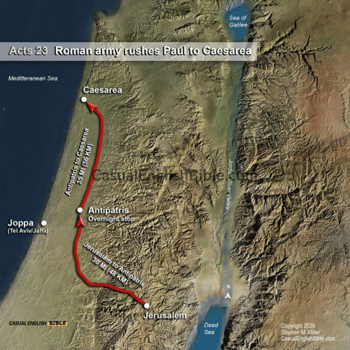
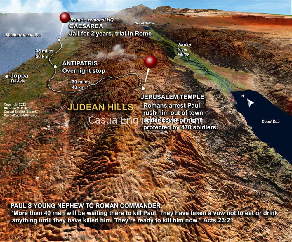
Paul Escorted Under Guard: Jerusalem to Caesarea (Acts 23)
Bible Map – Acts 23:12–35
Acts 23 reads like a political thriller, and this map puts the tension on the ground. After Paul is arrested in Jerusalem, more than forty men swear an oath to kill him. The plot is serious—and already in motion. The only reason Paul survives is because Roman authorities act quickly and decisively.
This map traces the urgent nighttime transfer from Jerusalem to Caesarea, the Roman headquarters on the Mediterranean coast. The route cuts west through the rugged Judean hills, descending toward the plains. Along the way, the soldiers stop at Antipatris before continuing on to the coast, where the terrain becomes easier and the immediate threat fades.
The distance—about 60 to 65 miles—helps explain the strategy. Roman commanders deploy overwhelming force: roughly 470 soldiers, including infantry, cavalry, and spearmen. This isn’t a routine escort. It’s a high-security extraction designed to prevent an ambush at all costs.
By the time Paul reaches Caesarea, the situation has changed. What began as a local religious dispute in Jerusalem becomes a formal Roman legal case. This transfer marks a turning point in Acts, moving Paul’s story into the sphere of imperial authority and setting the stage for his eventual journey to Rome.
This map helps you visualize how terrain, distance, and Roman infrastructure shaped the outcome—and how close Paul came to being killed before his mission could continue.
What You Get
- A detailed 3D-style map of Paul’s escorted journey in Acts 23
- Clearly marked route from Jerusalem to Caesarea
- Key locations identified, including Antipatris and the coastal plain
- Accurate terrain showing the descent from the Judean hills
- Visual context for the Roman military escort and emergency transfer
- Ideal for teaching, preaching, and personal Bible study