

Comprehensive Bible Atlas
$75.00
Mount Hermon, Damascus, Hamath, Tyre, Sidon
$10.00
What You Get When You Buy This Map
- detailed 3D map of Mount Hermon and the Lebanon Mountains
- Clearly marked locations in the area
- Ideal for teaching Zechariah 9
-
Instant digital download for personal study
- Optional licensing available for sermons, classes, livestreams, and online Bible studies
Description
From Mount Hermon to Galilee
Water from the heights
The snow-capped peaks of Mount Hermon rise over 9,200 feet (2,800 meters), feeding the headwaters of the Jordan River. Springs from its slopes gather near Dan, forming the river that flows south through Galilee, into the Sea of Galilee, and eventually all the way to the Dead Sea. Hermon’s melting snow makes life possible for the valleys below. Without it, the Jordan River would shrink to a stream for much of the year.
The gateway to the north
To the north and west lie the Lebanon Mountains and the Bekaa Valley, ancient trade and military routes linking Israel with Phoenicia and Syria. Cities like Tyre and Sidon on the coast became seaports of the ancient world, exporting cedar wood and purple dye. Caravans passed through mountain gaps like the Hamah Pass, carrying goods—and sometimes armies.
Battlegrounds and blessings
The northern frontier was both beautiful and dangerous. Hazor, one of the cities shown here, was a major Canaanite stronghold that Joshua’s army destroyed (Joshua 11). Later, during the time of the kings, these lands were where invading armies from Aram (Syria) often crossed into Israel.
A landscape of promise
Yet this same region later became a center of peace and hope. Jesus grew up in nearby Galilee, taught beside this lake, and called his first disciples from its shores. The story of faith that began in the deserts of the south found new life here—between the mountains, rivers, and fertile plains of Israel’s north.
Damascus, Hamath, Tyre, and Sidon, which are cities and kingdoms doomed to fall, according to Zechariah's prophecy in Zechariah 9.
With 1,000 PDF maps and more than 1,200 pages, the Comprehensive Bible Atlas is your one-stop solution for Bible maps.
There are two files. One optimized for mobile devices. A higher resolution version is available, too.
- Size: 1.2 GB (highest resolution); 157 MB (mobile device resolution)
- Length: 1298 pages
- Maps: over 1,000 Bible maps, many in 3-D style, with more coming soon
- Updates: Free
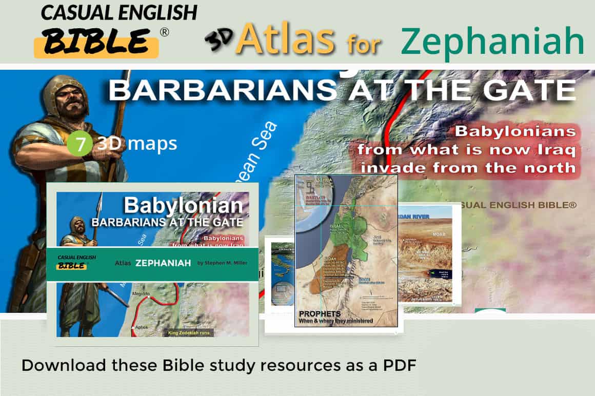
Zephaniah Bible Atlas
- Maps: 7 high resolution, many 3D Bible maps
- Pages: 14
- File sizes: 2 MB/mobile; 12 MB/higher resolution
Maps come in two versions. One optimized for use in mobile devices. Another in higher resolution for study and presentation.
$19.00


