Matthew - Leaders Guide & Atlas
$49.00
Temptation of Jesus
$10.00
What You Get with This Map
- High-resolution JPEG map suitable for screens, presentations, and printing
- Clear labeling of key locations tied to Matthew 4
- Terrain-based perspective showing elevation, wilderness, and travel routes
- Designed for Bible study, teaching, sermons, and personal use
- Immediate digital download after purchase
Description
Temptation of Jesus — Matthew 4
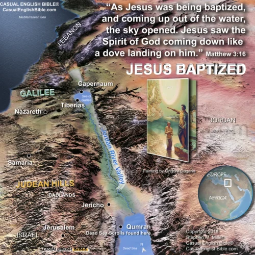
After his baptism, Jesus did not head straight into public ministry. According to Matthew, he went in the opposite direction—into isolation, hunger, and spiritual testing. This map places the Temptation of Jesus in its real-world geography, anchoring the story in the harsh landscape east of Jerusalem where tradition says the events unfolded.
The badlands of Judea were not symbolic wilderness. They were rugged, barren, and unforgiving. This terrain helps explain the intensity of the moment: forty days of fasting, solitude, and confrontation before Jesus ever preached a sermon or healed a sick person.
Where the Temptation Took Place
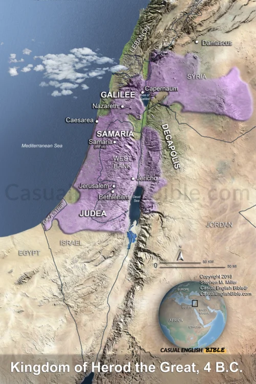
The map traces the setting described in Matthew 4, highlighting the Judean wilderness near Jericho and the Jordan River Valley. It shows the proximity to Jerusalem and the steep, winding route that descends from the city into the badlands—terrain well suited for both isolation and exposure.
This geography matters. The temptation narrative is not abstract theology; it is rooted in a specific place, shaped by elevation changes, climate, and distance from population centers. Seeing the land helps readers grasp why this was a place of testing.
Why This Map Matters
Matthew presents the temptation as the launching point of Jesus’ ministry. Before teaching crowds or challenging religious leaders, Jesus faced temptation alone. This map gives teachers, readers, and students a visual anchor for that moment—connecting Scripture to the land where it happened.
What You Get with This Map
- High-resolution JPEG map suitable for screens, presentations, and printing
- Clear labeling of key locations tied to Matthew 4
- Terrain-based perspective showing elevation, wilderness, and travel routes
- Designed for Bible study, teaching, sermons, and personal use
- Immediate digital download after purchase
Licensing (Optional)
Optional licensing is available for an additional $10 for use in:
- Books and printed publications
- Church materials
- Classroom and educational resources
- Other published or distributed works
(Standard purchase covers personal use and digital display only.)