
Luke - Leaders Guide & Atlas
$39.00
Bethany to Jerusalem, a short walk
$10.00
What you get when you purchase this map
- High-resolution 3D map of the route from Bethany to Jerusalem
- Clearly marked path across the Mount of Olives ridge
- Biblical context connecting Luke 19 to the Triumphal Entry
- Geographic perspective showing elevation and terrain
- Accurate placement of key locations including Bethany and the Temple area
- Instant digital download for teaching, study, or presentation
Description
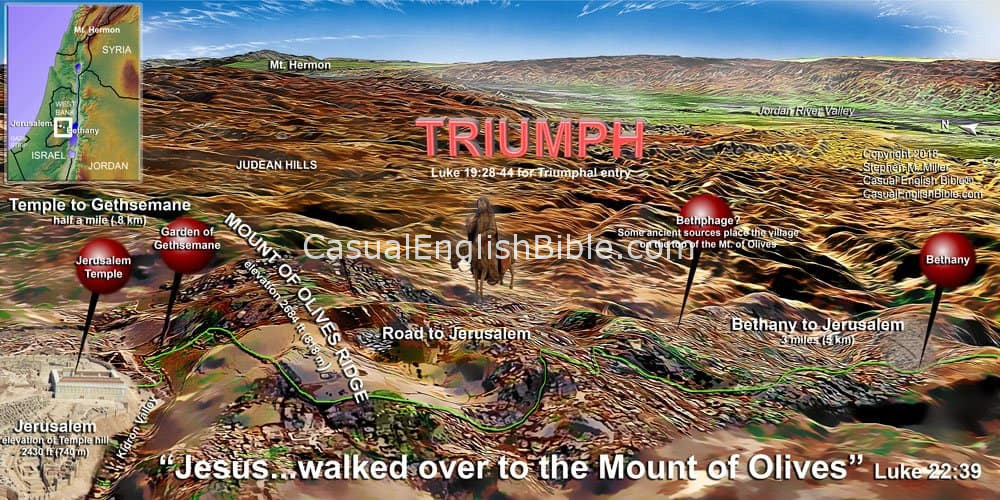
Triumphal Entry Map: Bethany to Jerusalem via the Mount of Olives
This Bible map of the Triumphal Entry traces Jesus’ final approach to Jerusalem as he traveled from Bethany across the Mount of Olives and down toward the city.
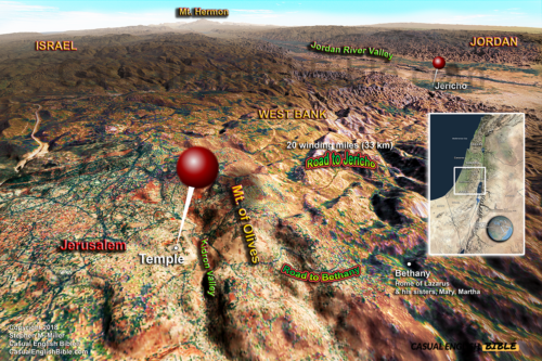
Bethany sat just a couple of miles east of Jerusalem, on the far side of the Mount of Olives. The road between them was short but steep, rising and falling along the ridge before descending toward the city gates. It was a familiar route—one Jesus and his disciples likely walked many times.
According to Luke 19, this is the path Jesus took as he entered Jerusalem to public acclaim. Crowds gathered along the הדרך, turning an ordinary road into a moment of celebration that marked the beginning of the final week of his life.
This map shows that route in real terrain, including the ridgeline, valleys, and key locations along the way. It helps readers see the distance, elevation, and setting behind one of the most recognized scenes in the Gospels.
What you get when you purchase this map
- High-resolution 3D map of the route from Bethany to Jerusalem
- Clearly marked path across the Mount of Olives ridge
- Biblical context connecting Luke 19 to the Triumphal Entry
- Geographic perspective showing elevation and terrain
- Accurate placement of key locations including Bethany and the Temple area
- Instant digital download for teaching, study, or presentation