Deuteronomy Bible Atlas
$39.00
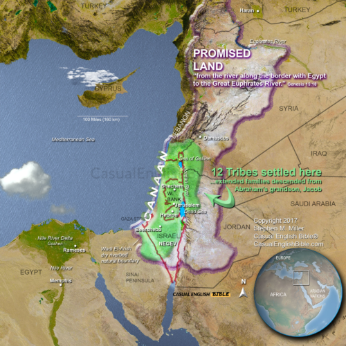
Promised Land Road
$10.00
What you get when you purchase this map
- High-resolution 3D map of Israel’s Exodus route toward the Promised Land
- Clearly marked path from Kadesh through the Negev and around Edom
- Biblical context connecting Numbers 20–21 to the journey and conflicts
- Geographic perspective showing deserts, mountains, and river boundaries
- Key locations labeled including Mount Hor, Moab, and the Jordan River
- Instant digital download for teaching, study, or presentation
Description
Exodus Route Map: Israel’s Final Journey to the Promised Land
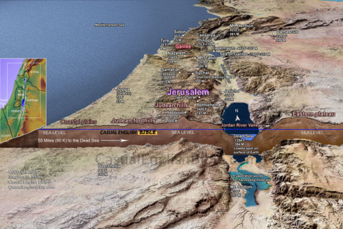
This Exodus route map traces the final leg of Israel’s long journey through the wilderness as they approached the Promised Land from the south and east.
After 40 years in the desert, the Israelites moved north from the Sinai region toward Canaan. But the direct route was blocked. Nations like Edom refused them passage, forcing a long and dangerous detour through harsh terrain. Along the way, the people faced hardship, including the deadly snakebite crisis recorded in Numbers 21.
This map follows that winding path—from Kadesh through the Negev, around Edom, and north along the eastern side of the Jordan River. It shows key locations such as Mount Hor, the plains of Moab, and the Arnon River, where Israel finally prepared to enter the land God had promised.
When diplomacy failed, conflict followed. Israel fought its way through opposing nations and took control of territory east of the Jordan. Some tribes—Reuben, Gad, and half of Manasseh—chose to settle there, drawn by fertile land ideal for livestock.
By placing these events into real geography, this map helps readers understand the distance, obstacles, and turning points that shaped Israel’s arrival at the edge of the Promised Land.
What you get when you purchase this map
- High-resolution 3D map of Israel’s Exodus route toward the Promised Land
- Clearly marked path from Kadesh through the Negev and around Edom
- Biblical context connecting Numbers 20–21 to the journey and conflicts
- Geographic perspective showing deserts, mountains, and river boundaries
- Key locations labeled including Mount Hor, Moab, and the Jordan River
- Instant digital download for teaching, study, or presentation