Psalms Bible Atlas
$39.00
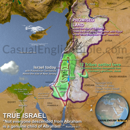
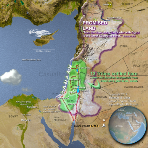
Twelve tribes of Israel
$10.00
What you get when you purchase this map
- A high-resolution digital map of the 12 tribes of Israel
- Clearly defined tribal territories across Canaan
- Accurate placement of tribes east and west of the Jordan River
- Geographic context including mountains, valleys, and coastlines
- Visual support for understanding Joshua and the settlement of Israel
- Suitable for Bible study, teaching, projection, or printing
Description
12 Tribes of Israel Map:
Territories, Geography, and Biblical Context
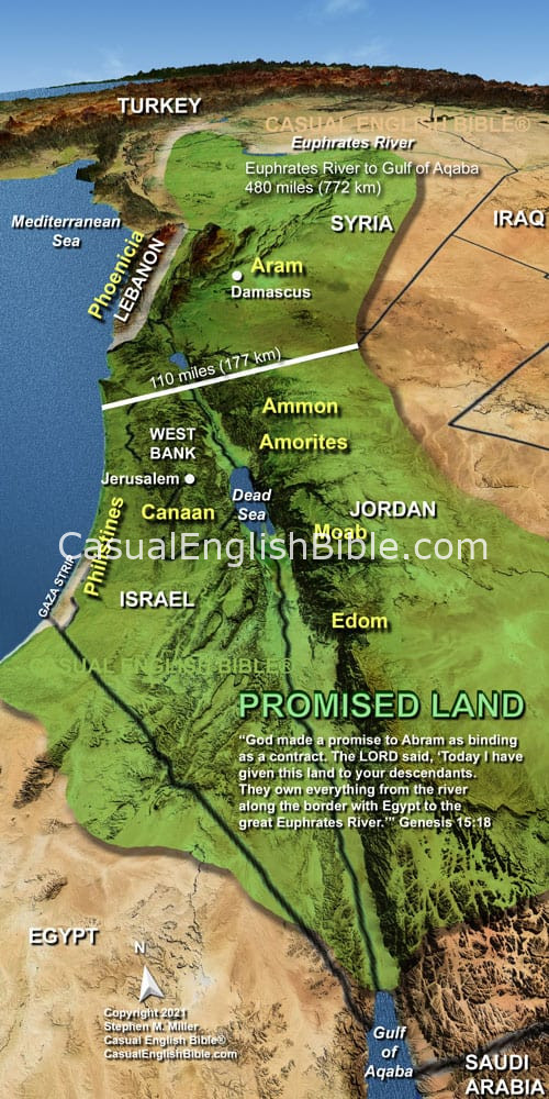
This 12 Tribes of Israel map shows how the land of Canaan was divided among the tribes after Israel entered the Promised Land, as described in the book of Joshua.
Following the conquest, the tribes spread out across a region that includes modern-day Israel and the West Bank. Each tribe received its own territory, shaped by geography—coastlines, mountains, valleys, and desert.
Three tribes—Reuben, Gad, and half of Manasseh—settled east of the Jordan River, where open land provided ideal pasture for livestock. The remaining tribes settled west of the Jordan, occupying land that stretched from the Mediterranean Sea to the Jordan River.
This map highlights the placement of each tribe, including Judah in the south, Ephraim and Manasseh in the central highlands, and tribes such as Naphtali and Asher in the north. It also reflects the unique role of the tribe of Levi, which did not receive a single territory but lived among the other tribes as priests and caretakers of worship.
The geography helps explain the story. Israel’s tribes lived in a land of hills, fertile valleys, coastal plains, and wilderness—regions that shaped their identity, economy, and conflicts. This map provides a clear visual framework for understanding how the tribes were organized before the kingdom was united under kings.
What you get when you purchase this map
- A high-resolution digital map of the 12 tribes of Israel
- Clearly defined tribal territories across Canaan
- Accurate placement of tribes east and west of the Jordan River
- Geographic context including mountains, valleys, and coastlines
- Visual support for understanding Joshua and the settlement of Israel
- Suitable for Bible study, teaching, projection, or printing

Comprehensive Bible Atlas
1,000+ Bible maps
Many in immersive 3D-style terrain so you can visualize the land, not just read about it
1,298 pages
A massive, chapter-by-chapter visual companion to the Bible
Two versions included
📱 Mobile-optimized (157 MB) — fast, smooth, and easy to use on phones & tablets
🖥️ Full-resolution (1.2 GB) — maximum detail for deep study and large screens
Covers the entire Bible
Every book with meaningful geography—from Genesis to Revelation
$75.00