
Deuteronomy Bible Atlas
$39.00
Promised Land boundary extended
$10.00
What you get
- Custom-made for The Casual English Bible®
- PDF image 2000 pixels
- Available for immediate download
- Licensing available for publication
Description
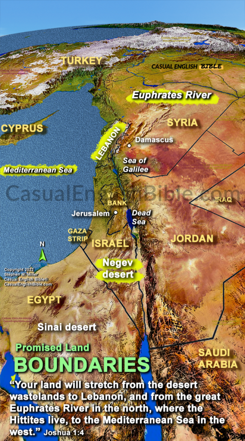
Israel’s Boundaries Weren’t Always the Same
The Bible doesn’t give just one map of Israel. Instead, it offers several descriptions of the land, each shaped by a different moment in Israel’s story. Some passages describe a small homeland that Israel was preparing to settle. Others describe a much larger, hope-filled territory tied to God’s long-range plans for his people.
The Big Vision in Exodus 23
One of the widest descriptions shows up in Exodus 23. God tells Moses that he will give Israel land stretching “from the Red Sea to the Sea of the Philistines, and from the desert to the Euphrates River.” That’s a huge area. But Exodus isn’t giving a surveyor’s report. It’s painting a picture of the largest territory Israel could enjoy if they followed God’s lead and lived out the covenant.
The points of the compass are clear enough:
- Red Sea as the southern anchor
- Mediterranean coast on the west
- Desert lands to the south and east
- Euphrates River far to the northeast
It’s a promise meant to inspire, not a border that Israel fully controlled at the time.
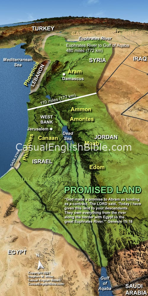
Other Passages Draw Smaller Lines
Other books narrow the focus. Numbers 34 lists detailed boundaries for the land Israel would actually settle after entering Canaan. Deuteronomy 1 and Joshua 1 give yet another version, centered on the territory Israel was about to take during the conquest.
Why the Boundaries Differ
These aren’t contradictions. They’re different angles—some legal, some historical, some hopeful. Exodus 23 is the wide-angle view: a vision that helped shape Israel’s identity and later maps of what the land could be at its fullest.