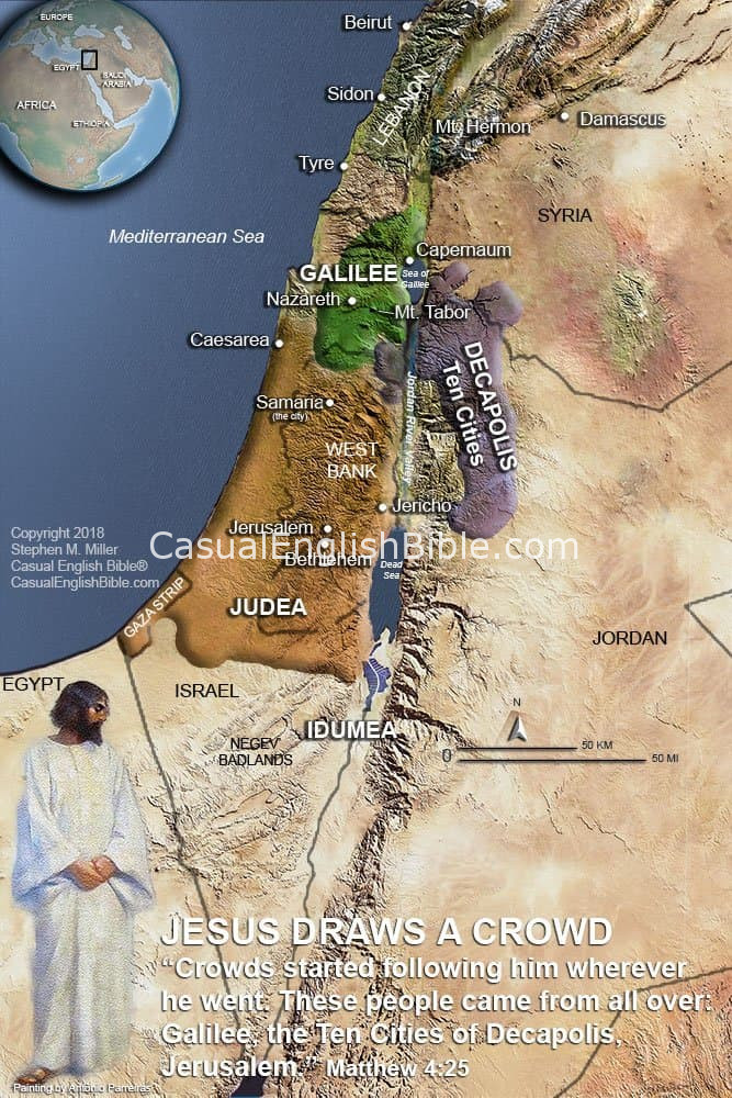
Jesus Draws a Crowd — The Decapolis (Ten Cities)
By the time Jesus began teaching and healing publicly, word spread fast. This map shows why. The Decapolis—literally “ten cities”—was a loose federation of Greco-Roman cities east of the Jordan River. It was culturally diverse, heavily Gentile, and well connected by roads and trade routes.
Matthew says crowds came to Jesus from Galilee, Judea, Jerusalem, and the Decapolis. This map puts that statement on the ground. You can see how people from distant regions could realistically hear about Jesus and travel to see him, even across political and cultural boundaries.
A Borderland Region That Amplified the Message
The Decapolis sat between worlds—Jewish lands to the west, Gentile cities to the east, Roman influence everywhere. Jesus didn’t confine his impact to one religious or ethnic group. This map visually explains how his reputation spread beyond Galilee and Judea into the wider Roman world.
You’ll see:
-
The full Decapolis region labeled as a unified area
-
Its proximity to Galilee, the Sea of Galilee, and the Jordan River Valley
-
Major population centers that helped carry news rapidly
-
The geographic reason crowds could gather in such large numbers
This map pairs naturally with Matthew 4:25 and works especially well for teaching, preaching, and Bible study focused on the scope of Jesus’ early ministry.