Map of ancient Israel
$10Map of ancient Israel east of the Jordan River: East Manasseh, Gad, Reuben tribes of Israel.
Casual English Bible
By Stephen M. Miller

Over 1,000 Casual English Bible® maps tell Bible stories in a captivating way that engages even people who have never read the Bible. Lavishly detailed maps only make the stories of Jesus and others more compelling and easier to picture and to understand.
These 3D-style maps of Bible lands are created from blended high resolution satellite images, matched to precise elevation data from international space agencies.
—Type “Galilee” into the Casual English Bible's map search engine, below. Instantly, you'll see dozens of beautiful maps…many in 3D style. Each one tracks with a different Bible story. These aren't generic maps with a hundred place names.
—Type “Samson” into the Bible map search engine. You'll see the tiny village where he lived in the Judean foothills below Jerusalem.
—Type “Corinthians” and you'll see a gallery full of maps associated with Paul's letters of 1, 2 Corinthians, to the church in Corinth, Greece.
Get a feel for the lay of the land:
—Ararat Mountains, where Noah’s boat ran aground. The Bible doesn’t say it was Mount Ararat.
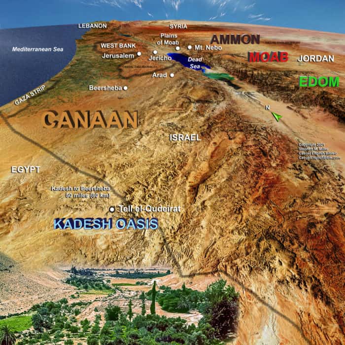
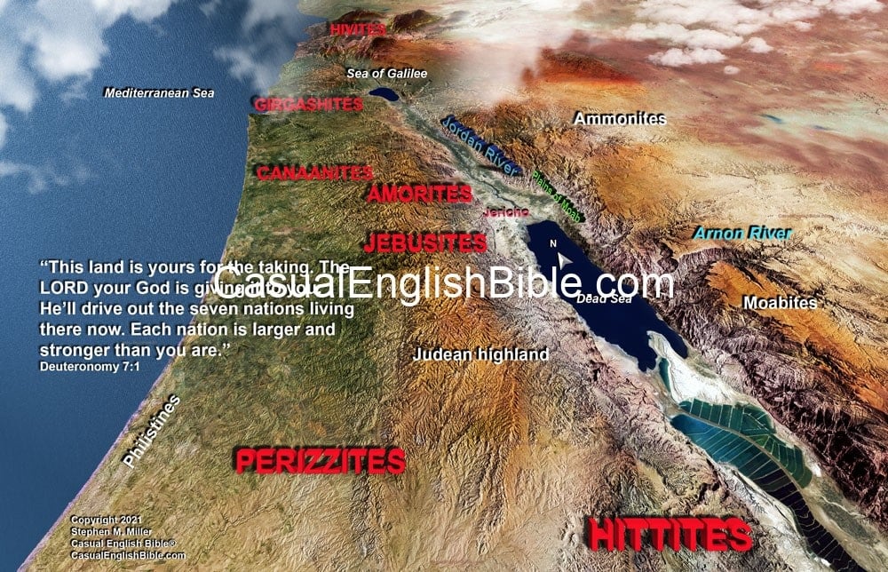
—Judean hills where Joshua and the Israelites found most of their battles for the Promised Land. They avoided the plains, where their enemies with armored chariots had the advantage over Israel’s foot soldiers.
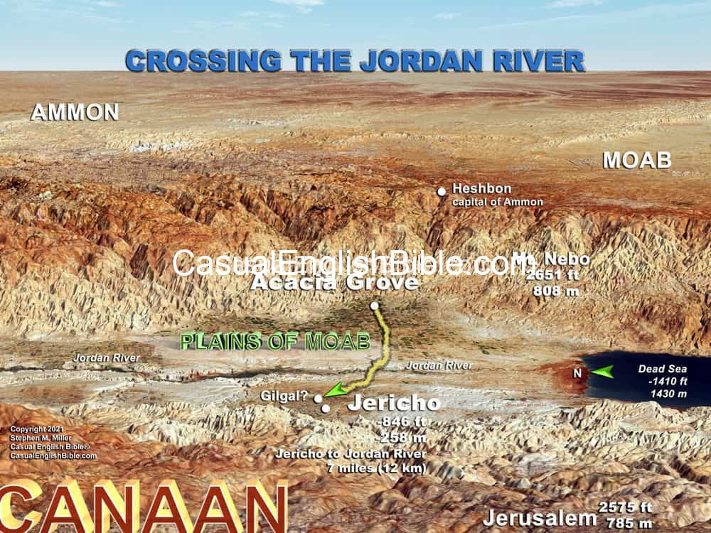
—Jesus’ 20-mile climb from Jericho and the Jordan River Valley upward half a mile high, to the crest of the Mount of Olives, overlooking Jerusalem.
—One surprise for some readers is the Jesus Triangle, a plug of ground between three cities. It’s where Jesus spent most of his ministry time. A person can walk that entire triangle in a single day. Type “Jesus triangle” to see it.


Invading Hebrews camped on the east bank of the Jordan River at Acacia Grove. The river valley was an important location in both the Old and New Testaments.
…


Map of the ancient city of Jezreel, with it's getaway palace of Israel's kings. It was located on the southern edge of the sprawling Jezreel Valley. Here is where an Israelite chariot corps commander launched a coup
…

With 1,000 PDF maps and more than 1,200 pages, the Comprehensive Bible Atlas is your one-stop solution for Bible maps. There are two files. One optimized for mobile devices. A higher resolution version is available, too. Size: 1.2 GB (highest resolution); 157 MB (mobile device resolution) Length: 1298 pages Maps: over 1,000 Bible maps, many in 3-D style, with more coming soon Updates: Free
Yes, all maps sold on this website are under copyright. You need a license to publish, distribute, or share The Casual English Bible® (TCEB) copyrighted maps. There are cases when licensing is not necessary, however. Learn more
Depends on how you intend to use the map(s) you download.
NO License Needed if…
License IS Required if…
You need a license for everything else including:
Printed copies distributed
Sermons streamed, broadcast
Websites/blogs
Videos
Social media
To get licensing for a map or atlas you choose the licensing option before adding the product to your cart. (See Example Screenshot)

At checkout, the license will be applied to your purchase.
Every license we issue is for one year (1 year), renewable as desired. During that time you may use the map or maps as often as you like in a manner that complies with our licensing agreement.
Approved and licensed uses
For the duration of the 1-year license you may use the maps as often as you want. Licensed uses include the following.
We reserve the right to revise this list.
Yes. You can get universal licensing for every map and atlas on this website for $6.25/Month (billed annually).
That comes with 20% OFF all maps and atlases in the store.

Get Unlimited Licensing + 20% off all maps & atlases
Billed annually