Paul Escorted to Caesarea: A Midnight Rescue
Bible Map – Acts 23:12–35
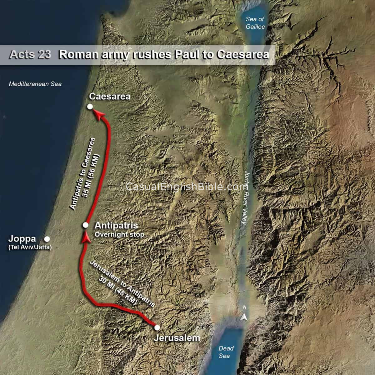
This map traces the urgent nighttime transfer of Paul from Jerusalem to Caesarea under heavy Roman guard. After a group of more than forty men swore an oath to kill him, the Roman commander acted quickly to prevent an ambush.
The escape began under cover of darkness. Paul was escorted by a large force—200 soldiers, 70 horsemen, and 200 spearmen—moving north toward the coast. The group traveled first to Antipatris, an overnight stop where the infantry turned back, leaving the cavalry to complete the journey.
From there, Paul was taken safely to Caesarea, the Roman administrative capital. He was delivered to Governor Felix along with an official report explaining the situation. What began as a local religious dispute had now become a matter for Roman authority.
This map highlights the route, distance, and terrain involved in that rapid evacuation. It shows how Roman infrastructure and military protection played a key role in preserving Paul’s life at a critical moment.
Seeing the geography makes the story clearer. This wasn’t a quiet transfer—it was a high-stakes operation carried out across real roads, through vulnerable territory, and under the threat of assassination.
What you get with this map
- A high-resolution Bible map of Paul’s transfer to Caesarea
- Clearly marked route from Jerusalem to Caesarea via Antipatris
- Distance and terrain that explain the urgency of the journey
- Historical context for Acts 23:12–35
- Detailed 3D-style geography for visual clarity
- Instant digital download
- Ideal for teaching, sermons, classrooms, and personal study
