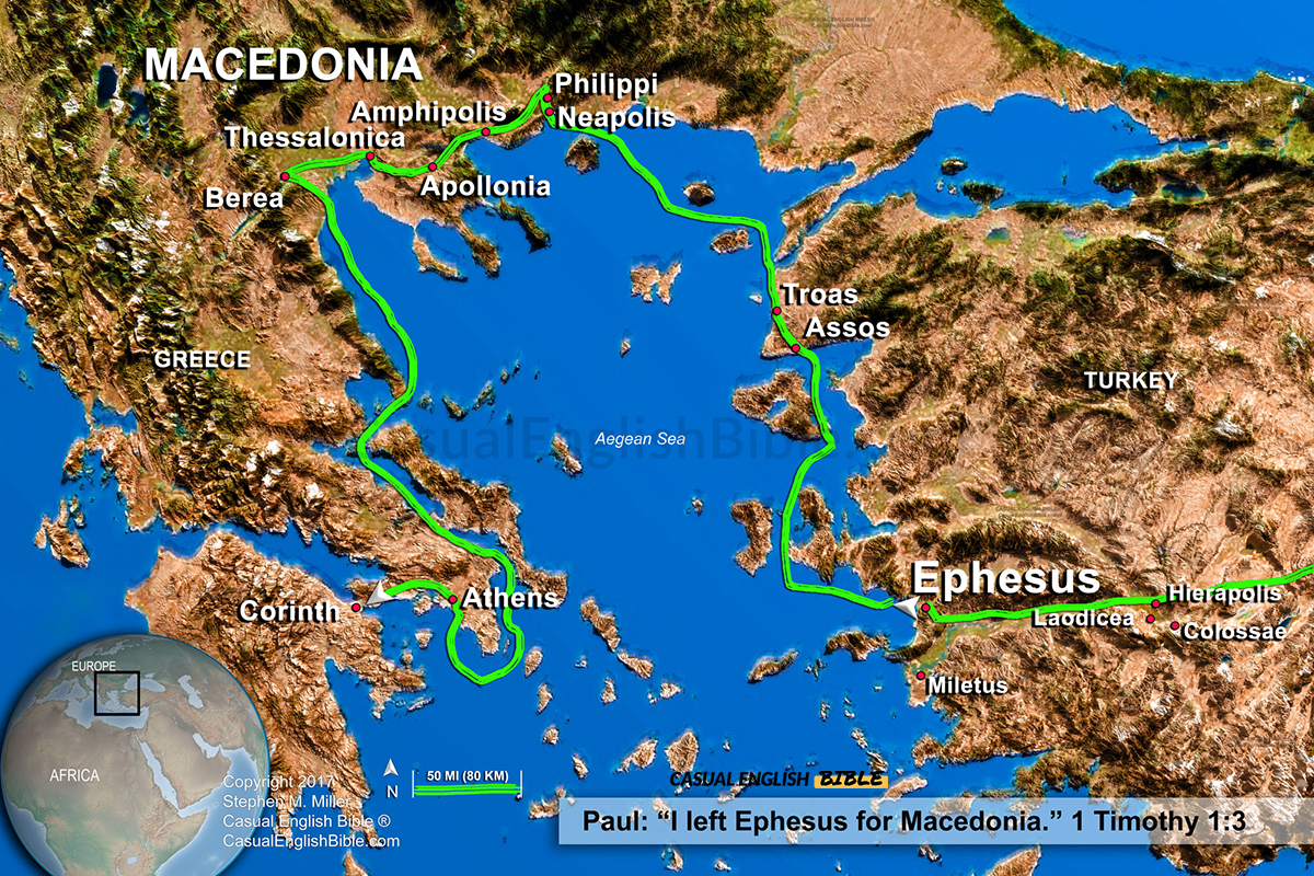
From Ephesus to Macedonia
This map traces part of the apostle Paul’s travels across the Aegean world, connecting the cities where he taught, encouraged believers, and built early churches. In 1 Timothy 1:3, Paul mentions leaving Ephesus for Macedonia—a simple line that represents a long and demanding journey across land and sea.
The route shown here loops through key locations in Greece and Asia Minor, including Ephesus, Troas, Philippi, Thessalonica, Berea, Athens, and Corinth. These weren’t short trips. Paul traveled hundreds of miles by foot and by ship, moving between cultures, languages, and political regions as he carried the message of Jesus.
The geography helps explain the challenge. The Aegean Sea is filled with islands and unpredictable waters, while the inland routes wind through mountains and valleys. This wasn’t just travel—it was endurance, persistence, and purpose.
This map helps you follow Paul’s path visually, connecting his letters to real places and showing how far the message spread in just a few years.
What you get
- Custom-made for The Casual English Bible®
- High-resolution JPG image
- Map tracing Paul’s route between Ephesus and Macedonia
- Key New Testament cities clearly labeled
- Geographic context of land and sea travel in the Aegean region
- Available for immediate download
- Licensing available for publication
