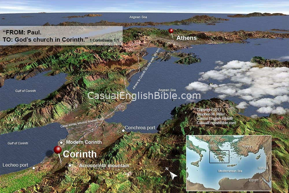
Paul’s Journey from Athens to Corinth
Background map for 1 Corinthians
After a brief and frustrating stay in Athens, the apostle Paul made the short but strategic journey west to Corinth—a move that would shape the rest of his ministry. This map traces the likely route Paul traveled as he left the intellectual center of Greece and headed toward one of the most influential cities of the Roman world.
The distance between Athens and Corinth was only about 50 miles (80 km), yet the contrast between the two cities was striking. Athens was known for philosophy and debate, while Corinth thrived on commerce, travel, wealth, and moral excess. Paul likely traveled overland across the Isthmus of Corinth, a narrow land bridge connecting northern and southern Greece. This map highlights key features of that route, including major roads, ports, and the strategic geography that made Corinth a crossroads of trade.
Corinth’s importance is further illustrated by its two harbors—Lechaion on the Gulf of Corinth and Cenchrea on the Aegean side—giving it access to both eastern and western trade routes. Its elevated position near Acrocorinth also made it a defensible and commanding city.
Unlike Athens, where Paul saw limited response, Corinth became a center of long-term ministry. Paul stayed there for about eighteen months, working alongside Aquila and Priscilla, preaching regularly, and establishing a church that was vibrant but troubled. His time in Corinth later led to some of his most personal and corrective letters, including 1 Corinthians.
This map helps readers visualize the geography, strategy, and cultural contrasts that made Corinth such a pivotal location in the early Christian movement.
