Bible maps worth canvas space
Some 3D Bible maps work beautifully as screensaver wallpaper or as art on the home office wall—or the living room, for an attractive conversation starter.
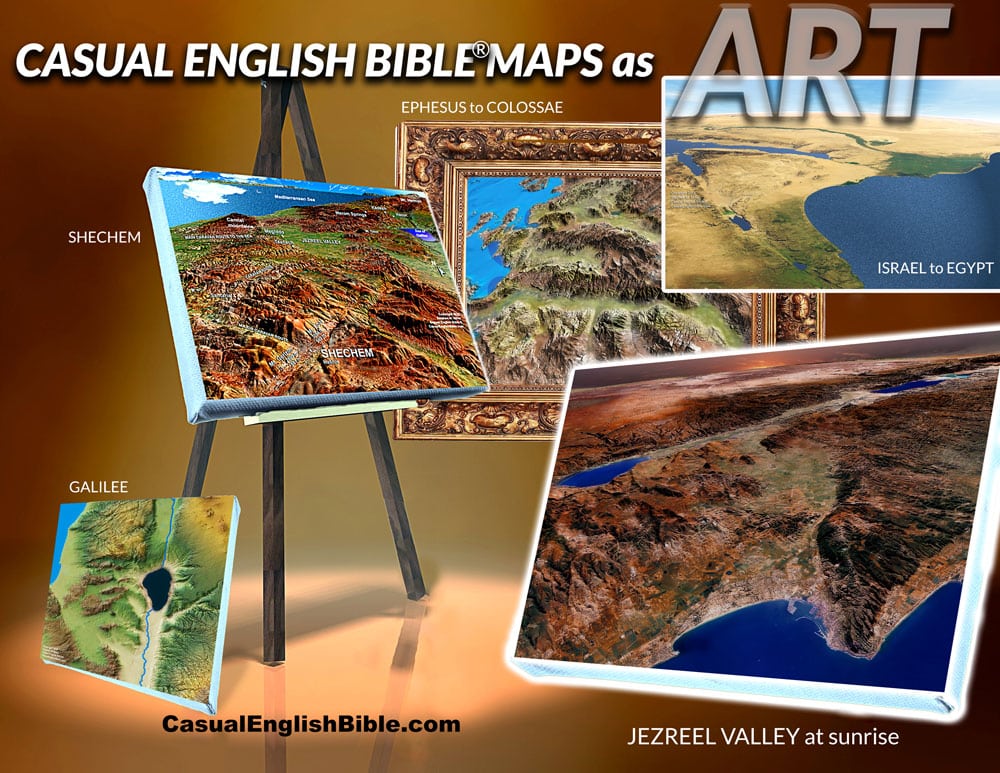
Educational art
“What in the world is that?”
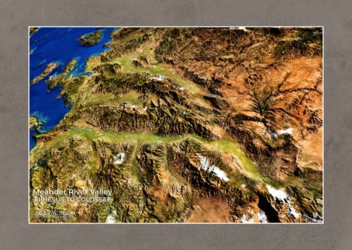
“It’s the apostle Paul’s mission field in western Turkey—the Meander River Valley. Ephesus was on the coast at the west end of the valley. Colossae is 120 miles inland on the east end. Paul never visited Colossae, but he wrote the letter of Colossians to the church there.”
Barebone maps
You’ll get to say that every time someone asks what they’re looking at. That’s because the maps come bare bones. No place names. Just the lay of the land.
But if you prefer the place names, you can have them added at no extra cost.
Pick a map for a wall poster
Wall posters made from full-resolution maps are a lot less expensive than buying them on canvas or even than licensing them at full resolution so you can make your own poster. Prices vary per size.
As I type this, prices are at about $10 for an 11 x 14-inch poster…up to 36 x24 inches for about $40.
Pick out a map, pick and approximate size, and contact us for a price. info@casualenglishbible.com
Four maps as art
We selected four maps to showcase in the gallery of Bible maps as art.
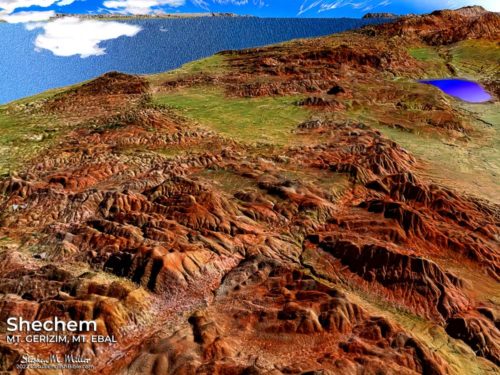
Shechem at the foot of twin hills, Mount Gerizim and Mount Ebal. Shechem is where God first told Abraham, “I’m going to give this land to you and your family” (Genesis 12:7). Joshua took Israelites there to renew their promise to follow the laws God gave them.
Moses’ view of the Promised Land. This is the scene from where the Bible says Moses stood, on the top of Mount Nebo in what is now Jordan. Moses never made it across the Jordan River. He died at age 120. So Joshua led the Israelites across the river and into battle.
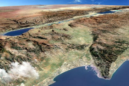
Jezreel Valley. Some call it the Valley of Armageddon. The Jordan River Valley lies in the distant east. Jezreel Valley has long been the farmer’s heaven. It’s still Israel’s breadbasket. But the fertile ground has soaked up a lot of blood. Many armies have clashed in this sprawling valley. French General Napoleon once called it the perfect battlefield.
Ephesus to Colossae River Valley. Lines, textures, and colors of the green valleys, rugged mountains topped in snow, and the Aegean Sea produce a scene reminiscent of NASA images. Those are photos shot from space and displayed as beautiful and intriguing images fit to showcase in an art gallery.
Showing all 4 results
-
Sale!

Shechem – Mt Gerizim – Mt Ebal map on canvas
Original price was: $235.00.$114.00Current price is: $114.00. Read more -
Sale!

Mt Nebo’s view of Promised Land – map on canvas
Original price was: $228.00.$105.00Current price is: $105.00. Read more -
Sale!

Jezreel Valley map on canvas
Original price was: $257.00.$124.00Current price is: $124.00. Add to cart -
Sale!

Ephesus-Colossae River Valley – map on canvas
Original price was: $277.00.$148.00Current price is: $148.00. Add to cart